York (City of York)
 |
 |
The city was founded under the name of Eboracum in 71 AD. It then became the capital of the Roman province of Britannia Inferior, and later of the kingdoms of Deira, Northumbria, and Scandinavian York. In the Middle Ages, it became the northern England ecclesiastical province's centre, and grew as a wool-trading centre. In the 19th century, it became a major railway network hub and confectionery manufacturing centre. During the Second World War, part of the Baedeker Blitz bombed the city; it was less affected by the war than other northern cities, with several historic buildings being gutted and restored up to the 1960s.
The city is one of 15 in England to have a lord mayor, and one of two to have The Right Honourable title affixed, the other being London's. Historic governance of the city was as a county corporate, not included in the county's riding system. The city has since been covered by a municipal borough, county borough, and since 1996 a non-metropolitan district (the City of York), which also includes surrounding villages and rural areas, and the town of Haxby. The current district's local council is responsible for providing all local services and facilities throughout this area. The city had a population of 153,717 in the 2011 census; the wider district had a population of 198,100. According to census data, the wider district has a population of 202,800, a 2.4% increase compared to the 2011 census.
The name York (Jórvík) is derived from the Brittonic name Eburākon (Latinised as Eboracum or Eburacum), a combination of eburos "yew tree" (compare Old Irish ibar, Irish iobhar, iubhar, and iúr, and Scottish Gaelic iubhar; compare also Welsh efwr and Breton evor, both meaning "alder buckthorn") and a suffix of appurtenance *-āko(n), meaning "belonging to,” or “place of" (compare Welsh -og). Put together, these old words meant "place of the yew trees". (In Welsh, efrog; in Old Irish, iubrach; in Irish Gaelic, iúrach; and in Scottish Gaelic, iùbhrach). The city is called Eabhrac in Irish and Eabhraig in Scottish Gaelic—names derived from the Latin word Eboracum. A proposed alternative meaning is "the settlement of (a man named) Eburos," a Celtic personal name spelled variously in different documents as Eβουρος, Eburus and Eburius: when combined with the Celtic possessive suffix *-āko(n), the word could be used to denote the property of a man with this name.
The name Eboracum became the Anglian Eoforwic in the 7th century: a compound of Eofor-, from the old name, and -wic, meaning “village,” probably by conflation of the element Ebor- with a Germanic root *eburaz ('boar'); by the 7th century, the Old English for 'boar' had become eofor. When the Danish army conquered the city in 866, it was renamed Jórvík.
The Old French and Norman name of the city following the Norman Conquest was recorded as Everwic (modern Norman Évèroui) in works such as Wace's Roman de Rou. Jórvík, meanwhile, gradually reduced to York in the centuries after the Conquest, moving from the Middle English Yerk in the 14th century through Yourke in the 16th century to Yarke in the 17th century. The form York was first recorded in the 13th century. Many company and place names, such as the Ebor race meeting, refer to the Latinised Brittonic, Roman name.
The 12th‑century chronicler Geoffrey of Monmouth, in his fictional account of the prehistoric kings of Britain, Historia Regum Britanniae, suggests the name derives from that of a pre-Roman city founded by the legendary king Ebraucus.
The Archbishop of York uses Ebor as his surname in his signature.
Map - York (City of York)
Map


Country - United_Kingdom
 |
 |
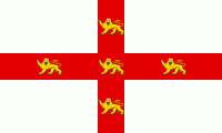
| Flag of the United Kingdom | |
The United Kingdom has evolved from a series of annexations, unions and separations of constituent countries over several hundred years. The Treaty of Union between the Kingdom of England (which included Wales, annexed in 1542) and the Kingdom of Scotland in 1707 formed the Kingdom of Great Britain. Its union in 1801 with the Kingdom of Ireland created the United Kingdom of Great Britain and Ireland. Most of Ireland seceded from the UK in 1922, leaving the present United Kingdom of Great Britain and Northern Ireland, which formally adopted that name in 1927. The nearby Isle of Man, Guernsey and Jersey are not part of the UK, being Crown Dependencies with the British Government responsible for defence and international representation. There are also 14 British Overseas Territories, the last remnants of the British Empire which, at its height in the 1920s, encompassed almost a quarter of the world's landmass and a third of the world's population, and was the largest empire in history. British influence can be observed in the language, culture and the legal and political systems of many of its former colonies.
Currency / Language
| ISO | Currency | Symbol | Significant figures |
|---|---|---|---|
| GBP | Pound sterling | £ | 2 |
| ISO | Language |
|---|---|
| EN | English language |
| GD | Gaelic language |
| CY | Welsh language |
